Curtis Wright Maps
We can help you find a piece of history, geography, and culture that fits your budget, interest and style.
ABOUT CURTIS WRIGHT MAPS
Curtis Wright Maps is a Chicago area map dealer, specializing in antique maps
The concept of a map can encompass many different meanings, ideas and interpretations. To Curtis Wright, they have always symbolized a mechanism for escape. Maps are an intersection of history, geography and culture that can transport their audience to a different time and a different place.
My Blog
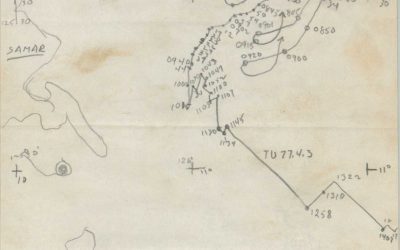
Recollections of the Battle of Surigao Straits (Samar Island)
Transcription of a previously unpublished account of the Battle off Samar from a signalman aboard the escort carrier U.S.S. Fanshaw Bay.
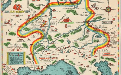
Trail of the Rainbow Division
The route of the 42nd Division across Europe during WWII is explored with this documentary and map.
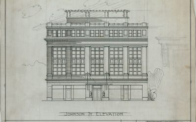
More than Maps – Architectural Diagrams of the Dane County Historical Society
An interesting project involving 20th century architectural diagrams from Wisconsin.
A Distant Branch of the Family Tree – Part I
The holiday season is a perfect time to reflect on family, especially those we miss most dearly....
Fairs & Events
Upcoming Events
– 05/03/24 – Capital Book Fair @ The University Club in Washington, D.C.
– 07/12/24 – Minnesota Antiquarian Book Fair @ Hamline University in St. Paul, MN.
Shop by Interests
[aws_search_form]
Shop
Showing 1–8 of 5714 results
-

G-2 Situation Map No. 1 [Battle of Iwo Jima]
$3,500.00 Quick View -

[Group of material related to an American POW]
$225.00 Quick View -

History of the 748 F.B. Bn. in E.T.O.
$295.00 Quick View -
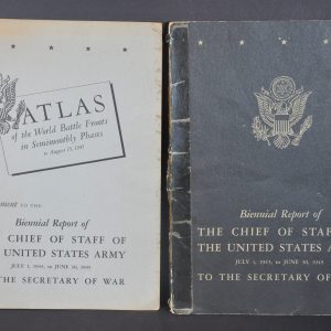
Biennial Report of the Chief of staff of the United States Army July 1, 1943, to June 30, 1945 to the Secretary of War
Quick View -

The World Divided
$95.00 Quick View -

Problems C. & G.S.S. Regular Course 1938 – 1939 Maps [Military Training Maps]
Quick View -

Report of Activities Army Ground Forces WWII
$75.00 Quick View -
Post Map Fort Belvoir, Virginia
$195.00 Quick View